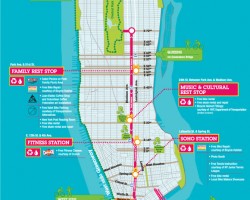
Summer Streets are coming back in August… For three Saturdays in August, New York City will have a 6.9 mile car-free path leading from the […]
Summer Streets are coming back in August… For three Saturdays in August, New York City will have a 6.9 mile car-free path leading from the […]
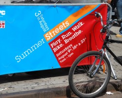
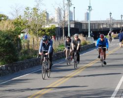
Photos taken during the Summer Streets events. Three Saturdays in August, New York City had a 6.9 mile car-free path leading from the Brooklyn Bridge […]
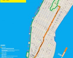
Please view the 2009 Summer Streets Page for the latest info and maps For three Saturdays in August, New York City will have a 6.9 […]
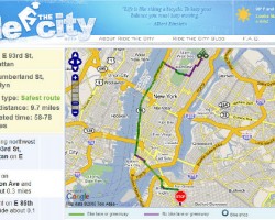
Ride the City is a new NYC bike routing site that allows you to enter two addresses and it will provide the best route to take by bicycle. Kind of like if NYC Bike Maps merged with Mapquest. Check it out at www.RideTheCity.com

Here are a few of the best websites for getting bike maps and bike ride info for the New York City region.
NYC Bike Maps .com is your online resource for bicycling in New York City. Our goal is to provide you with accurate maps, relevant information, […]
New York City has stated that they plan to add 70 miles of new bike lanes & bike routes to the city’s bicycle network in […]
NYCBikeMaps.com utilizes a five color legend to classify routes for cyclists. Bike Path / Greenway / Off-Street Path off-street bike path or designated path in […]