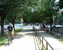
On June 15, 1894, Brooklyn’s Ocean Parkway became the home of the country’s first bike path. Inspired by the grand boulevards of Europe and designed […]
On June 15, 1894, Brooklyn’s Ocean Parkway became the home of the country’s first bike path. Inspired by the grand boulevards of Europe and designed […]
The NYC Bike Map now has a terrain view option that allows you to view the elevation of the surrounding area.
The New York City Bicycle Safety Coalition launched a new bike safety advertising campaign.
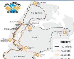
On Sunday September 9, 2007 5,000 cyclists will take to the streets of New York City and ride in Transportation Alternatives’ NYC Century Bike Tour.
The Google map tiles used by the NYC Bike Map have been updated to include subway and train stations. Subway stations will appear when the map is zoomed in.
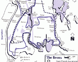
The Tour de Bronx, New York’s Largest Free Cycling Event, is Sunday, October 21, 2007. Visit TourdeBronx.org for more information and to register.
New York Cycling Club’s Thirteenth Annual Escape New York Bike Ride is Saturday October 13, 2007. Visit NYCC.org/eny07 for more details and to register ($30 […]
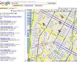
If you have a Gmail email account, then you can now add New York City’s bike paths and bike lanes to Google Maps with this new map widget.
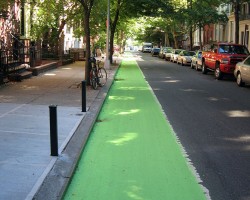
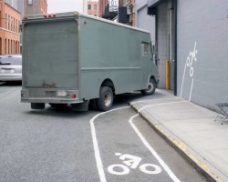
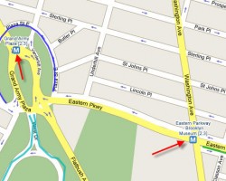
The DOT has painted the bike lane on Henry Street in Brooklyn green as part of a trial with colored bike lanes.
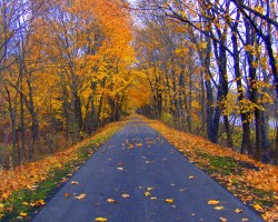
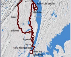
Westchester County, New York City’s neighbor to the North, is home to the North County & South County trailways. These Westchester trails are part of […]

Here are a few of the best websites for getting bike maps and bike ride info for the New York City region.
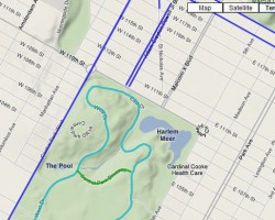
New York City just got it’s first mountain bike trail in Manhattan’s Highbridge Park.
for info on the 2008 Five Boro Bike Tour Sunday, May 6th, 2007. This legendary bike tour has nearly 30,000 New Yorkers of every stripe […]
NYC Bike Maps .com is your online resource for bicycling in New York City. Our goal is to provide you with accurate maps, relevant information, […]
New York City has stated that they plan to add 70 miles of new bike lanes & bike routes to the city’s bicycle network in […]
NYCBikeMaps’s new “Link to this Page” feature saves your current NYC Bike Map location, zoom, & map type.Simply click on the ‘Link to this page’ […]
Gothamist: Map of the Day: NYC Bike Maps! Google Summer of Green :: New York onNYTurf: NYCBikeMaps Google Map Hack Google Maps Mania: US fishing, […]