NYCBikeMaps.com just got a redesign and new logo. Couple of notable updates: more full screen maps for larger screens Mobile usability updates updates to maps, […]
Category: New Feature
New Look for NYC Bike Maps
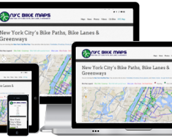
The nycbikemaps.com website received the largest update in more than three years. The changes to the look and feel of the site should be obvious […]
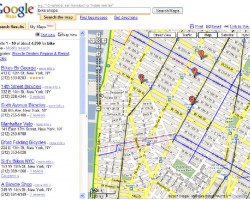
New Map: New York City Street View Bike Map
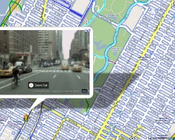
Google’s street view photography + the NYC Bike Map = the New York City Street View Bike Map
View street level photographs of New York City that allow you to zoom, pan, and rotate. Great for scouting and planning bike routes.
New Terrain View Map
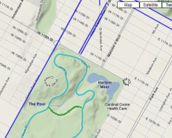
The NYC Bike Map now has a terrain view option that allows you to view the elevation of the surrounding area.
Map Update: Subway and Train Stations Now on Bike Map
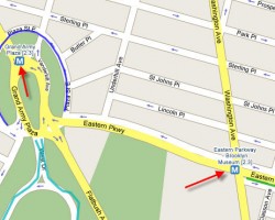
The Google map tiles used by the NYC Bike Map have been updated to include subway and train stations. Subway stations will appear when the map is zoomed in.
NYC Bike Map Widget for Google My Maps
If you have a Gmail email account, then you can now add New York City’s bike paths and bike lanes to Google Maps with this new map widget.
New Feature: Link to this Map
NYCBikeMaps’s new “Link to this Page” feature saves your current NYC Bike Map location, zoom, & map type.Simply click on the ‘Link to this page’ […]